enquiry quick enquiry
CADD Centre | Certified & Recognized CAD Training Centre in Chennai | cad courses | cad courses for beginners | cad centre near me | cad courses near me | cad learning | cad learning centre | cad training centreEnquiry CADD Centre | Certified & Recognized CAD Training Centre in Chennai | cad courses | cad courses for beginners | cad centre near me | cad courses near me | cad learning | cad learning centre | cad training centreQuick contact CADD Centre | Certified & Recognized CAD Training Centre in Chennai | cad courses | cad courses for beginners | cad centre near me | cad courses near me | cad learning | cad learning centre | cad training centreQuick contact

Computer Aided Land Survey using AutoCAD Civil 3D

OverviewOverview:

Land surveying is an important means of mapping land boundaries, slopes, distances and features to enable land development and accurate land registers.

Engineers, Surveyors and Drafters do Computer Aided Land Survey using AutoCAD Civil 3D to make landscape designs and process information from land surveys.

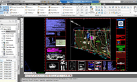
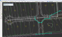
Computer Aided Land Survey using AutoCAD Civil 3D Computer Aided Land Survey using AutoCAD Civil 3D Computer Aided Land Survey using AutoCAD Civil 3D


Why to learnWhy to learn?

This course will cover the overview about AutoCAD Civil 3D for basic road design and land surveying. These workflows are straightforward in the creation of dynamic models and built based on applicable industry-recognized or user-defined standards.

The course will begin with the fundamentals and general workflow for building road models. Then the behaviors and functionality of the overall road model and its individual components are described.


Learning objectiveLearning Objectives:

CADD Center will help you to ace the associated features of Computer Aided Land Survey using AutoCAD Civil 3D:

  • Introduction to Land Survey and AutoCAD Civil 3D
  • Survey creation based on the survey data from
    • Theodolite
    • Total Station
    • LiDAR
    • Google Earth
    • DEM Files
  • Surface Styles
  • Surface Analysis
  • Earthwork Calculation
    • Cut and Fill Volume
    • Grading
    • Profile View Generation
  • Site Layout


Learning OutcomeLearning Outcome:

  • Student will be able to create survey reports on the basis of various survey data.
  • Student will learn about surface styles and analysis.
  • Student will be able to calculate earthwork.
  • Student will know about site layout.

© CADD Centre 2023, All rights reserved

CADD CENTRE Anna Nagar


AC-3, 2 nd Floor
2 nd Avenue(Next to Turakhia Opticals),
Anna Nagar,
Chennai - 600040.

Ph : 4350 0770 / 4350 0771
Email : [email protected]

CADD CENTRE Nelson Manickam Rd


3 rd Floor, 1 st Wing,
Nelson tower, (Near Bata Showroom),
Nelson Manickam Road,
Chennai - 600029.

Phone : 2374 6026 / 2374 6027
Email: [email protected]

CADD CENTRE Padi


# 6, MTH Road,
DABC Complex, (Opp Wheels India),
Padi,
Chennai - 600050.

Phone : 2654 6686 / 2654 6687
Email : [email protected]